By Andrew King, The University of Melbourne
It’s winter in Australia, but as you’ve probably noticed, the weather is unusually warm. The top temperatures over large parts of the country this weekend were well above average for this time of year.
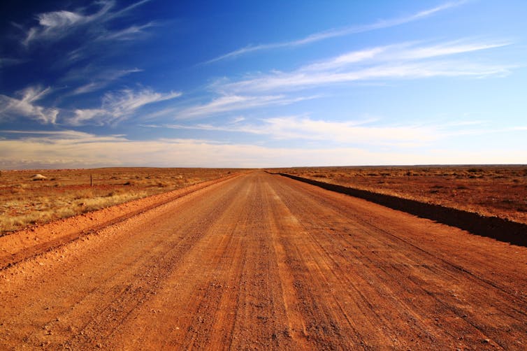
The outback town of Oodnadatta in South Australia recorded 38.5°C on Friday and 39.4°C on Saturday – about 16°C above average. Both days were well above the state’s previous winter temperature record. In large parts of Australia, the heat is expected to persist into the coming week.
A high pressure system is bringing this unusual heat – and it’s hanging around. So temperature records have already fallen and may continue to be broken for some towns in the next few days.
It’s no secret the world is warming. In fact, 2024 is shaping up to be the hottest year on record. Climate change is upon us. Historical averages are becoming just that: a thing of the past.
That’s why this winter heat is concerning. The warming trend will continue for at least as long as we keep burning fossil fuels and polluting the atmosphere. Remember, this is only August. The heatwaves of spring and summer are only going to be hotter. https://www.youtube.com/embed/GmhMKjxEGQo?wmode=transparent&start=0 Widespread heat forecast for Australia in August, 2024 (Bureau of Meteorology)
Records broken across Australia
The Bureau of Meteorology was expecting many records to be broken over the weekend across several states. On Thursday, bureau meteorologist Angus Hines described:
A scorching end to winter, with widespread heat around the country in coming days, including the chance of winter records across multiple states for maximum temperature.
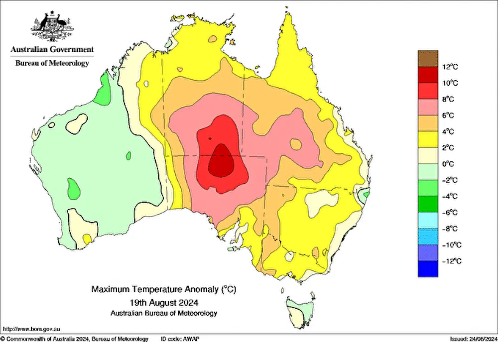
The amount of heat plunging into central Australia was particularly unusual, Hines said.
On Friday, temperatures across northern South Australia and southern parts of the Northern Territory were as much as 15°C above average.
Temperatures continued to soar across northern parts of Western Australia over the weekend, with over 40°C recorded at Fitzroy Crossing on Sunday. It has been 2–12°C above average from Townsville all the way down to Melbourne for several days in a row.
Bear in mind, it’s only August. As Hines said, the fire weather season hasn’t yet hit most of Australia – but the current conditions – hot, dry and sometimes windy – are bringing moderate to high fire danger across Australia. It may also bring dusty conditions to central Australia.
And for latitudes north of Sydney and Perth, most of the coming week will be warm.
What’s causing the winter warmth?
In recent days a stubborn high pressure system has sat over eastern Australia and the Tasman Sea. It has kept skies clear over much of the continent and brought northerly winds over many areas, transporting warm air to the south.
High pressure promotes warm weather – both through clearer skies that bring more sunshine, and by promoting the descent of air which causes heating.
By late August, both the intensity of the sun and the length of the day has increased. So the centre of Australia can really warm up when under the right conditions.
High pressure in June can be associated with cooler conditions, because more heat is lost from the surface during those long winter nights. But that’s already less of an issue by late August.
This kind of weather setup has occurred in the past. Late-winter or early-spring heat does sometimes occur in Australia. However, this warm spell is exceptional, as highlighted by the broken temperature records across the country.

Feeling the heat
The consequences of humanity’s continued greenhouse gas emissions are clear. Australia’s winters are getting warmer overall. And winter “heatwaves” are becoming warmer.
Australia’s three warmest Augusts on record have all occurred since 2000 – and last August was the second-warmest since 1910. When the right weather conditions occur for winter warmth across Australia, the temperatures are higher than a century ago.
The warmth we are experiencing now comes off the back of a recent run of global temperature records and extreme heat events across the Northern Hemisphere.
This warm spell is set to continue, with temperatures above 30°C forecast from Wednesday through to Sunday in Brisbane. The outlook for spring points to continued above-normal temperatures across the continent, but as always we will likely see both warm and cold spells at times.
Such winter warmth is exceptional and already breaking records. Climate change is already increasing the frequency and intensity of this kind of winter heat – and future warm spells will be hotter still, if humanity’s greenhouse gas emissions continue.
Andrew King is a Senior Lecturer in Climate Science, The University of Melbourne
This article is republished from The Conversation under a Creative Commons license. Read the original article.